As I turned off the highway and onto the county road, I made the call. My husband answered.
“I’m going in,” I said.
“Okay,” he replied, “Let me know when you’re out.”
We hung up and I drove on, squinting in the sun, trying to find the brown road sign denoting a historic site. Ah. There it is.
“Fort Bowie,” it said, with an arrow pointing east. “8 miles.”
I had scouted this route using National Park Service website’s directions and Google maps (satellite view). I knew that there was nothing but undulating dirt road ahead, with some dips down into arroyos. Most of them were likely dry but after an unusually wet monsoon season in southern Arizona, some of them might be running. I was not driving a truck or an SUV; there would be no cell service.

The road was in pretty decent shape until about 5 miles in. Then it narrowed and the ruts got deeper, the rocks in the road larger. There was a sharp descent into an water-filled arroyo, followed by an equally sharp ascent. I kept an eye on my mileage. 6 ½ miles. 7 miles. Finally, I rounded a final twisting turn and saw the parking lot.
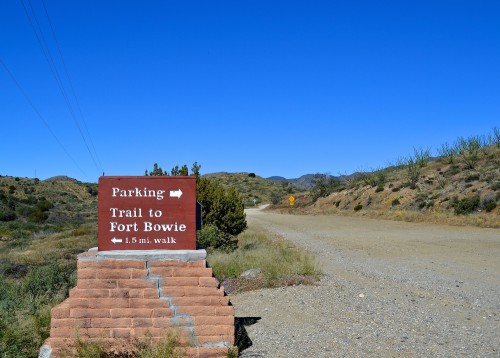
I pulled in, stopped the car, and sighed with relief. But my nervousness did not abate. Across the road from the lot were a restroom, some historical markers, and a trailhead.
“Trail to Fort Bowie,” the sign said. “1.5 mi. walk.”
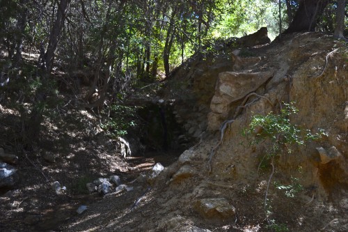
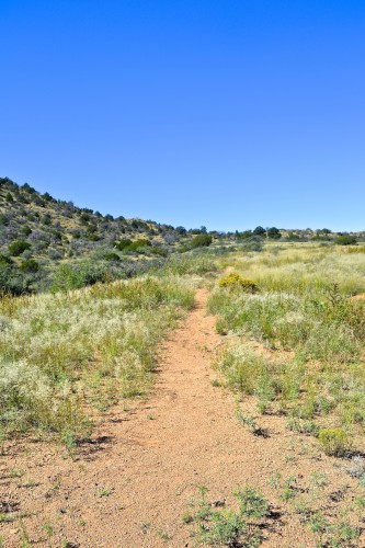
I began to load water, snacks, and my camera into my backpack. I locked the car, prayed no one would break into it while I was gone, and started up the trail.
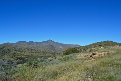
I was there to see Apache Pass, a high desert corridor between the Chiricahua and the Dos Cabezas mountains. The Pass was in constant use for hundreds of years because the area contained wood, water, and grass—all essentials for communities on the move through the desert. In 1849, it became an important stop along an “emigrant trail” that prospective miners took from El Paso to the California gold fields and in 1858, Congress established an overland mail route up and over the Pass.
The increased traffic through the area caught the attention of Chiricahua Apaches and initiated more than ten years of raids and battles, creating a landscape of violence in which Native Americans and Anglo Americans fought one another over control of the Southwest and its natural resources.

I hiked up the trail, accompanied by whirring clouds of grasshoppers. It was not particularly hot (I was there in the morning in early October so it was in the mid-70s) but Apache Pass ascends to over 5,000 feet of elevation and air is dry. This high desert double-whammy means that anyone walking at a regular pace on a sunny day will rapidly become winded and dehydrated. No wonder Apache Spring—the only water source in a fifty-mile radius—was a convening site for people and animals in the nineteenth century.
I walked past a marker noting the location of the “Bascom Affair,” a bloody battle between U.S. soldiers and Cochise’s band of Chiricahua Apaches in February 1861, the result of mistaken assumptions and disastrous diplomatic strategies on the part of the Federals.
Further on were the ruins of the Butterfield Mail stage station; the Bascom battle and subsequent attacks and raids prompted John Butterfield to abandon this station and others along its route in March 1861. An advance guard of James Carleton’s California Column also fought with Cochise and Mangas Coloradas and their men here in July 1862. As a result of that fight, the Union army established Fort Bowie on a hill overlooking the Pass.

I wandered around the ruins of the first Fort Bowie (a second, much larger compound was built a bit further up the hill in 1868) and then made my way to the ranger station.
There I met a young Park Service ranger, who was delighted to see me. We talked about the site and the trail to it, and the nerve-wracking dirt road. I shopped for books and began to accumulate quite a pile before I suddenly realized that I had to hike back down the trail. A backpack laden with 15 pounds of books was going to make that even sweatier work than coming up the trail had been.
“Well, I could drive you back to the parking lot,” said the ranger.
I was stunned. There was an easier way to get here? The ranger explained that the National Park Service website suggests the 8-mile dirt road for no real reason at all. There was another route, a paved road from the town of Bowie that turned to dirt for about a mile from the parking lot, approaching from the other direction. But that mile of dirt, he warned me, was pretty dicey.
“We take two spare tires with us in all the trucks,” he said. “We blow them out on that stretch all the time.”
I was willing to take that chance.
So the ranger drove me back to the parking lot, and waited as I threw my pack and my heavy bag of books in the car. Then he drove in front of me down the other access road. It was indeed dicey: a stretch of large, sharp rocks and then deep ruts the rest of the way to the pavement. I honked and waved at the ranger as he turned off to return to the station, and I drove on to the town of Bowie.
As I did, I wondered, is Apache Pass the Most Extreme Civil War Site in America?

There are other places like this in the Southwest, mostly in New Mexico: Fort Union, which sits at the end of a four-mile dirt road into the middle of the Jornada del Muerto; the nearby battlefield of Valverde, which is located on private land (a ranch of Ted Turner’s) and can be accessed only in the dry season and with permission from the ranch manager; and Cooke’s Canyon, another site on the Overland Mail and U.S. military route, which is unmarked on most maps and which you can only reach in an SUV with serious clearance.
The remoteness of these sites provides some pleasures: you need not elbow anyone out of your way to take a good look around. Just by getting there you feel like a badass (as much as one can feel like a badass with air conditioning). The isolated nature of these sites also means that they are relatively well-preserved; the topography of Apache Pass today looks much as it did in the 1860s, the ruts of the Butterfield Mail road still mark its route.
But these sites of Extreme History in the desert Southwest are also problematic. The Fort Bowie ranger told me that the National Park Service is aware that the condition of the road dissuades potential visitors from driving all the way to the parking lot–many turn around after a couple of miles. The hike is not strenuous but it is long and the trail is exposed to the elements. There are no visitors who just happen upon the site; such spontaneity is impossible.
These remote landscapes make it difficult to convince people that the American Civil War actually happened in this region, thousands of miles from the eastern theater. But it did happen here–and we need to take that turn onto the dirt road and bump and jostle our way into this new understanding of the war in the West.
I was at Apace Pass in 1998. After seeing on TV & being a history lover. June, very hot. We all only took 1bottle of water. Wrong!!!!! Take plenty.And the dirt road going in seemed more like 15 miles.Saw the Adobe fort. The spring. And cemetery. It was all so breathtaking. The trail out is at the top of the mountain. Not too bad, wouldn’t advise if not healthy! One tip. We arrived at about 4:30. Wrong again. When the sun sets in Arizona, early compared to East in summer, its down at 7:00 boom. Go early. We got out just before it was dark. Think about your well-being before walking in blind like we did. Loved it all. Even if we if really couldve been in trouble. Elyce in PA.
What do they say about Manuel Chavez and the Polish Padre at the NPS site, I wonder.
http://www.longislandwins.com/news/detail/confederates_capture_santa_fe_and_plot_extermination
At Apache Pass? Or at Glorieta?
I remember the anxious drive up and down Rich Mountain, WV, in rain and thick fog, but at least I could stay in the car.
There are many national parks, monuments and other sites in the Southwest–and other areas, too, I am sure–which are only protected from overuse and vandalism by poor roads or remote locations. If the govt ever puts in a good paved road that makes it possible to drive to Chaco Canyon NHP from the south, its fragile pueblos will be in great danger. Not even the biggest ones are guarded, and you can walk out to the outlying smaller sites and dismantle them if you wanted to. Except for Yellowstone and its ilk, very few places have anything like the staff they need for securing their treasures. Thank God so few Americans can or will walk 3 miles.